| |||||||||||||||||||||||||||||||||||
| |||||||||||||||||||||||||||||||||||
CHAPTER III
STUDY AREAS
SITE SELECTION
The Wyoming State Board of Control, State Engineers Office and the Wyoming Water Development Office, over the years, have developed a list of potential study areas for conveyance loss analysis. The following criteria are used to select study reaches:
- Stream reaches which have a significant amount of historical streamflow data.
- Stream reaches which have a specific need for the determination of conveyance losses.
- Stream reaches whose conveyance losses could be correlated to other similar streams in the same area or other areas of the State of Wyoming.
From this list, two areas were selected as the basis for this paper. Reaches selected for study were:
- GREYBULL RIVER: from USGS Station Number 086276500 located at Meeteetsee, Wyoming to the Farmers and Bench Canals southwest of Burlington, Wyoming.
- WIND RIVER: from USGS Station Number 06227600 near Kinnear, Wyoming to USGS Station Number 06228000 near Riverton, Wyoming.
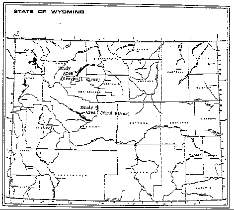
A map showing the location of both study areas is given on Figure 1.
SITE SETTING
Greybull River Study Reach
The Greybull River has its headwaters in the Carter Mountains of the Absaroka Range in northwestern Wyoming. The streamflow of the Greybull River is produced mainly by runoff from snowmelt with some as a result of rainfall. The river flow is also augmented by several small springs and streams along its course. The one tributary within the study reach of significance is Meeteetsee Creek. The Greybull River reach is approximately twenty-four miles in length.
The Greybull River floodplain alluvium consists of pebbles with small boulders which in some places is overlain by a one to three foot layer of silt and sand. Occasional sedimentary rocks outcrop at the edge of the flood plain alluvium. Terrace deposits consist mainly of rounded pebbles to small cobbles and are overlain by a layer of one to three feet of thick silt and sand. Alluvial deposits range from sandy clay to silty sand and are anywhere between five and sixty feet thick (Cooley and Head 1979).
Figure 1. Location of Study Areas
Water from the Greybull and Wood Rivers is stored in the Sunshine Reservoirs and discharges when needed into the Greybull River for use by downstream irrigators. The main crops in the area include: hay, corn, alfalfa, sugar beets and soybeans. Farmed lands are irrigated mainly by flood irrigation with a small amount of sprinkler irrigation.
Wind River Study Reach
The Wind River has its headwaters in the Wind River Mountains of central Wyoming. Streamflow in the Wind River can be accounted for mainly by runoff from snowmelt with some rainfall events. There are many small tributaries that flow into the Wind River along its flow path but they are all ephemeral streams which had no flow during the study period within the study reach. The length of the Wind River study reach is approximately 24.1 miles.
Water is diverted from the Wind River for use by farmers. Farmed lands are irrigated mainly by flooding methods with some sprinkler irrigation. Crops in the area include: sugar beets, hay, corn, and soybeans.
94-05 Table of Contents
Water Resources Publications List
Water Resources Data System Library |
Water Resources Data System Homepage