| |||||||||||||||||||||||||||||||||||
| |||||||||||||||||||||||||||||||||||
The Upper Green River Basin of Wyoming contains the headwaters of the Green River, one of four major tributaries to the Colorado River. The Basin encompasses approximately 17% of the land area in Wyoming and produces approximately 12% of the 15.8 million acre feet of water produced by the State. The water, originating mainly from snowfall, is vital to agriculture, tourism, municipalities, and industry.
Water produced within the Green River Basin of Wyoming is also important from a regional standpoint because downstream states, and even the Republic of Mexico, depend on a share of the water. The water originating within the Green River Basin of Wyoming is subject to the terms of the Upper Colorado River Basin Compact of 1948. Under the terms of the compact, each state is to assess its water uses directly attributable to the "works of man." Consumptive uses from naturally occurring vegetation are not considered a depletion according to the terms of the contract. In addition, collection and analysis of water use data provides essential information for decisions regarding the various proposals for alternate uses of the water within the State.
Agriculture is the largest land and water user within the Green River Basin with the major crops being irrigated alfalfa and mountain meadows. Information concerning the irrigation requirements of these crops in the Basin has been limited. Estimated water use rates are available (Trelease, et al., 1970) but have not been confirmed through extensive field measurements. Existing water use measurements within the Basin are several years old and are limited to one area (Burman and Loudon, 1967).
Objectives
The overall objective of this study was to develop technical data and models on evapotranspiration for the Upper Green River Basin. The specific objectives were:
Description of the Basin
The Green River Basin, situated in the Southwest corner of Wyoming (Figure 1), is considered climatically to be semi-arid. Typical annual precipitation normals are 7.61 inches at Farson, 8.60 inches at Big Piney, 8.79 inches at Rock Springs, 9.53 inches at Kemmerer, and 11.23 inches at Pinedale (U. S. Dept. Comm., 1973). Annual temperature normals include 34.5°F at Big Piney, 35.5°F at Pinedale, 36.9°F at Farson, 39.2°F at Kemmerer, and 42.5°F at Rock Springs. Average number of days between the last spring and first fall occurrence of low temperatures ranges dramatically across the Basin (Becker, et al., 1977). The average number of days between the last and first occurrence of 32° temperatures is 34, 60, 73, and 117 days at Pinedale, Farson, Kemmerer, and Rock Springs, respectively, while for 28°F temperatures the average number of days are 69, 92, 98, and 140 at Pinedale, Farson, Kemmerer, and Rock Springs, respectively.
High consumptive use rates within the Basin can be expected due to the dry-windy conditions, high radiation inputs as a result of the high elevations, and the oasis effect of irrigated agriculture and reservoirs. One or two cuttings of alfalfa are usually obtained with irrigation continuing throughout most of the growing season. Native hay is grown either for pasture or hay. The irrigation of the hay is often dependent upon water supplies, but usually continues until shortly before harvest.
General Approach
Development of evapotranspiration (ET) data and models within the Green River Basin was approached from the standpoint of incorporating both direct measurement and modeling techniques to define consumptive use rates. Direct measurements provided a data base to confirm the modeling efforts and permit calibration of different models. However, direct measurements were limited within cost and time restraints. Measurements included weekly ET rates during the growing season using non-weighing lysimeters with alfalfa, mountain meadow, and alta fescue vegetation. The lysimeters were installed duri ng the fall of 1982 and spring of 1983 with measurements taken during 1983, 1984, and 1985. The 1983 season was considered to be an establishment year for the vegetation in the lysimeters as far as calibration and analysis were concerned. Since the locations and time periods for which direct measurements could be taken were limited, additional data was taken throughout the Basin in the form of intensive climatic data. This was used as a supplement to the direct ET measurements and as an input to calibrated ET models to provide maximum ET estimates extrapolated over the entire basin.
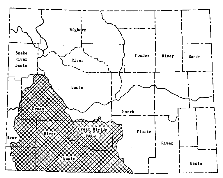
Figure 1. Map of Wyoming with the Green River Basin Shown.
87-06 Table of Contents
Water Resources Publications List
Water Resources Data System Library |
Water Resources Data System Homepage